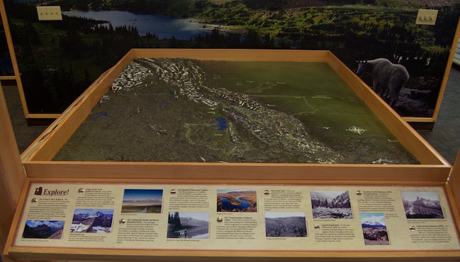
Interactive Topographic Map: Map-Making with Precision Board HDU
Precision Board HDU is great for creating dimensional signs of any size and shape, but it certainly doesn’t stop there: Precision Board is only limited by the ingenuity of the creator. We’re always searching for fresh, unique creations that show off the versatility of HDU, and today’s project by Casey Steinke of Top Sign and Graphics is exactly what we’re looking for. It’s an interactive topographic map in the Crown of the Continent Discovery Center, in the legendary Glacier National Park. The scale map measures an impressive 6’x7’, and depicts a tract of land from Idaho to Alberta, an area of over forty thousand square miles! The best part? It’s completely hand-painted. Let’s take a look at the build process.
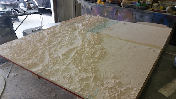
Just like any good cartographer, Casey started out with the cold hard data. To plot the details of the display, he used Google Maps satellite images along with GeoTIFF files, which include additional data like map projection and elevation values. This data can then be input to a 3D modeling software like Autocad and converted into tool paths for a CNC router. After routing out the surface of his map, Casey was left with a very bumpy HDU blank in need of some paint.

After routing came the first of many rounds of painting. Casey started by applying our FSC-88 WB primer to protect and seal the HDU, and to allow the paint to adhere correctly. For paint, he began with a neutral green base of latex acrylic paint, followed up by a coat of subdued brown to accentuate the jagged elevation changes. This shading does a lot to add visual depth and texture to the landscape.

After the initial coats had dried, Casey started on the detail work. There were hundreds of miles of rivers and lakes that needed to be depicted on the map, and Casey hand-painted every inch on the topographic map surface. Flathead Lake and Pend Oreille Lake are featured on the map, as well as long stretches of the Columbia River, Flathead River, and more.
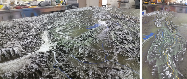
Continuing on with the detail work, Casey painted the snowcapped peaks and valleys of the Rocky Mountains, which cover a large part of the surface. As you can see in the picture above, it was a huge undertaking. He also painted major trails in yellow, hand-tracing them as they snaked though the icy terrain. Once the painting was completely finished, Casey used a water-based clear coat to protect his work and give it a glossy sheen.
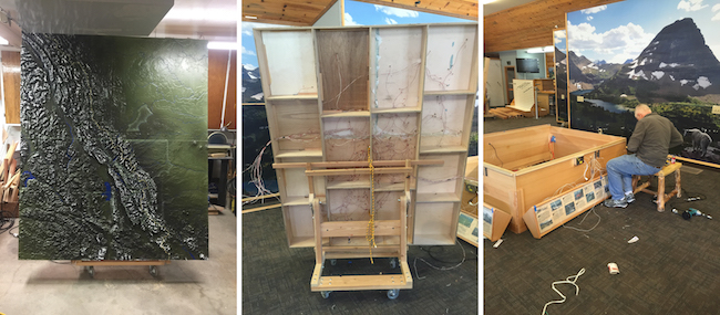
As if hand-painting more than 40,000 square miles of wilderness wasn’t enough, there was still more to be done. Casey began installing hundreds of LED lights to be linked to switches around the perimeter of the display. The idea was for visitors to be able to illuminate certain areas (National Park boundaries, Indian reservation borders, and more) at the touch of a button. Every LED was hand-placed and hand-wired, a process that took hours but made for an fun and interactive final product.
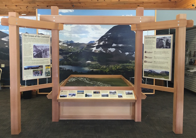
Finally, it was time for installation. The finished topographic map with LED’s was set in a robust wooden frame, with informational placards and the LED controls along the perimeter. The map was flanked by wooden frames with hanging informational signs, and backed by a large image of the sprawling national park.
The interactive topographic map was a huge undertaking, but Casey Steinke and Top Sign and Graphics pulled it off without a hitch. The lifelike landscape is popular with visitors to the Discovery Center, and it’s a great way for outdoors enthusiasts to get a birds-eye view of their favorite national park. Be sure to take a look at the Top Sign and Graphics website to see more projects like this, or to commission a professional display of your own!